
GAIT Global
GAIT has a suite of proprietary technologies purpose-built to unlock climate solutions at scale
We are proud of the technology we have built and the role it has in creating innovative and impactful climate solutions.
GAIT provides greater project data quality, volume and insights, delivering real-time feedback loops. Our MRV solution scales consistently across any ecosystem and methodology, enhancing project access, feasibility and uptake.
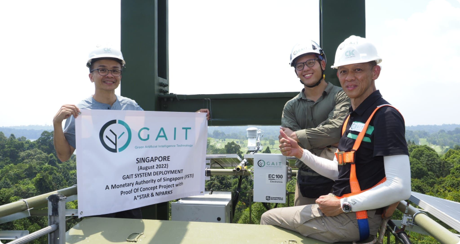
GAIT was awarded Monetary Authority of Singapore (MAS) Financial Sector Technology and Innovation (FSTI) Proof of Concept (POC) grant.
The FSTI POC grant provides funding support for experimentation, development, and dissemination of nascent innovative technologies in the financial services sector. GAIT utilised the grant to execute a proof of concept project to validate GAIT’s Measuring, Reporting and Verifying (MRV) solution as an integrative system to quantify carbon flux and carbon-related metrics.
GAIT, in collaboration with Agency for Science, Technology & Research (A*STAR) and The National Parks Board (NParks) selected the MacRitchie Reservoir as the ideal site for the POC project.

GAIT DMRV is a full end-to-end suite for digital measurement, reporting andverification of nature-based assets, including tropical forestry and terrestrialwetlands. GAIT validated this technology with The Agency of Science Technology, and Research (A*STAR), and the National Parks Board (NParks) through a proof of concept project.
- Full end-to-end, in-house geographic information systems and spatial suiteof technologies for carbon measurement, reporting and verification
- Proprietary artificial intelligence machine learning (AI/ML) models and algorithms integrated throughout the suite for automation and scalability,
- Ecosystem-agonistic system for blue, green and brown carbon use.

GAIT has developed a full end-to-end suite for the use of eddy covariance in open path and forced diffusion soil carbon flux sensors. This system enables real time monitoring across carbon flux and environmental parameters.
- Hourly carbon flux analysis
- Daily carbon flux analysis
- Diurnal pattern analysis
- Seasonality analysis
- Timeseries sequestration
- Environmental data analysis
- Sensor diagnostics
- Atmospheric rates
- Latent heat (H2O)
- AI/ML data imputation
GAIT’s highly innovative and newly developed suite, Spatial Processing for Efficient Calculations and Reports Automation (SPECTRA), is a unified platform that enables users to automate and streamline site analysis reports and feasibility assessments for carbon
projects.
SPECTRA combines industry-best-practice methodologies and GIS data with GAIT’s proprietary algorithms to deliver insights for users’ decision-making in assessing carbon project feasibility and project scenario analysis.